
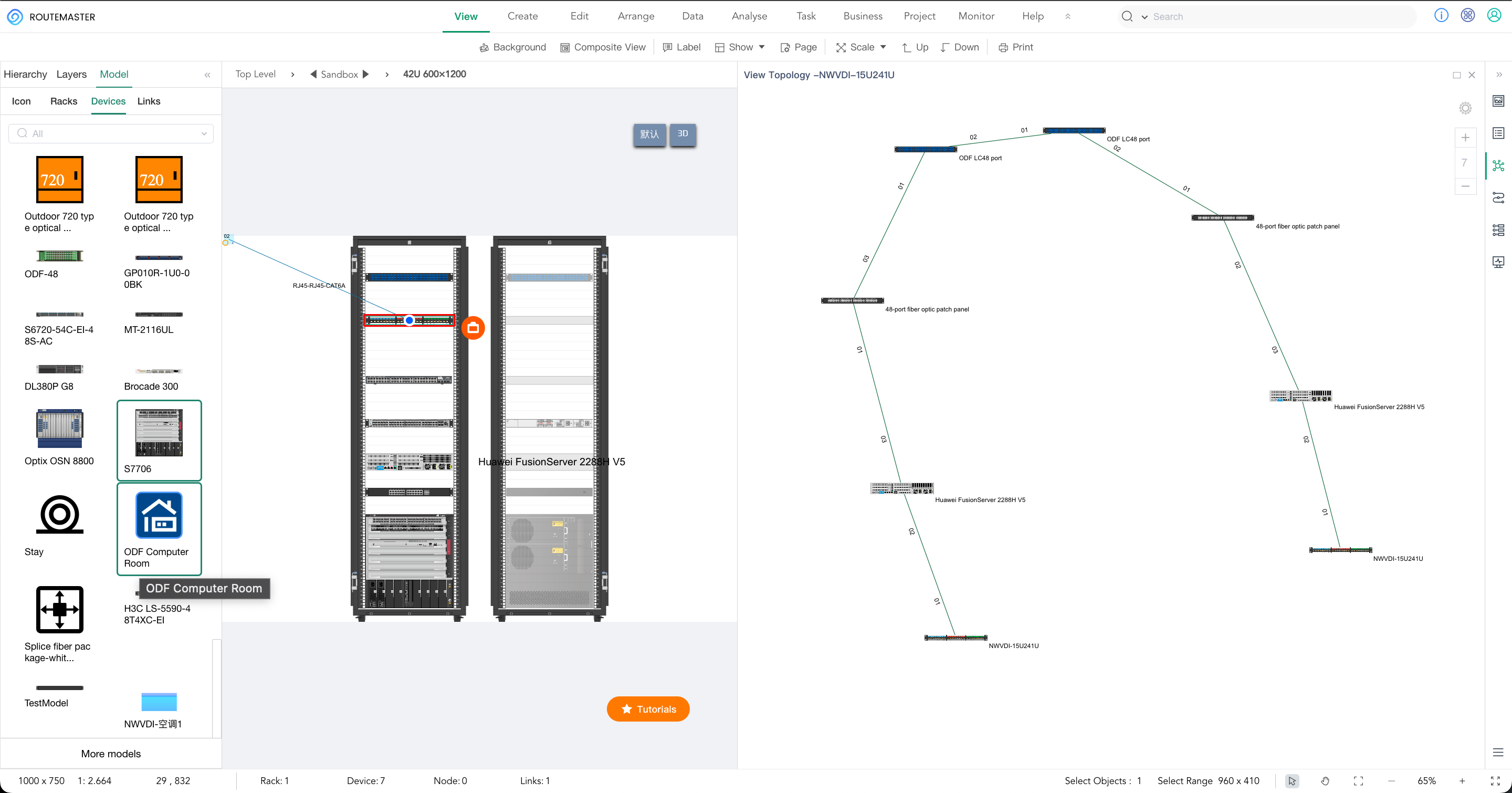
The Hidden Cost of Bad Cable Management
Infrastructure & Operations The Hidden Cost of Bad Cable Management Why 40% of data center downtime is self-inflicted — and what digital twins are doing about it. 40% of data


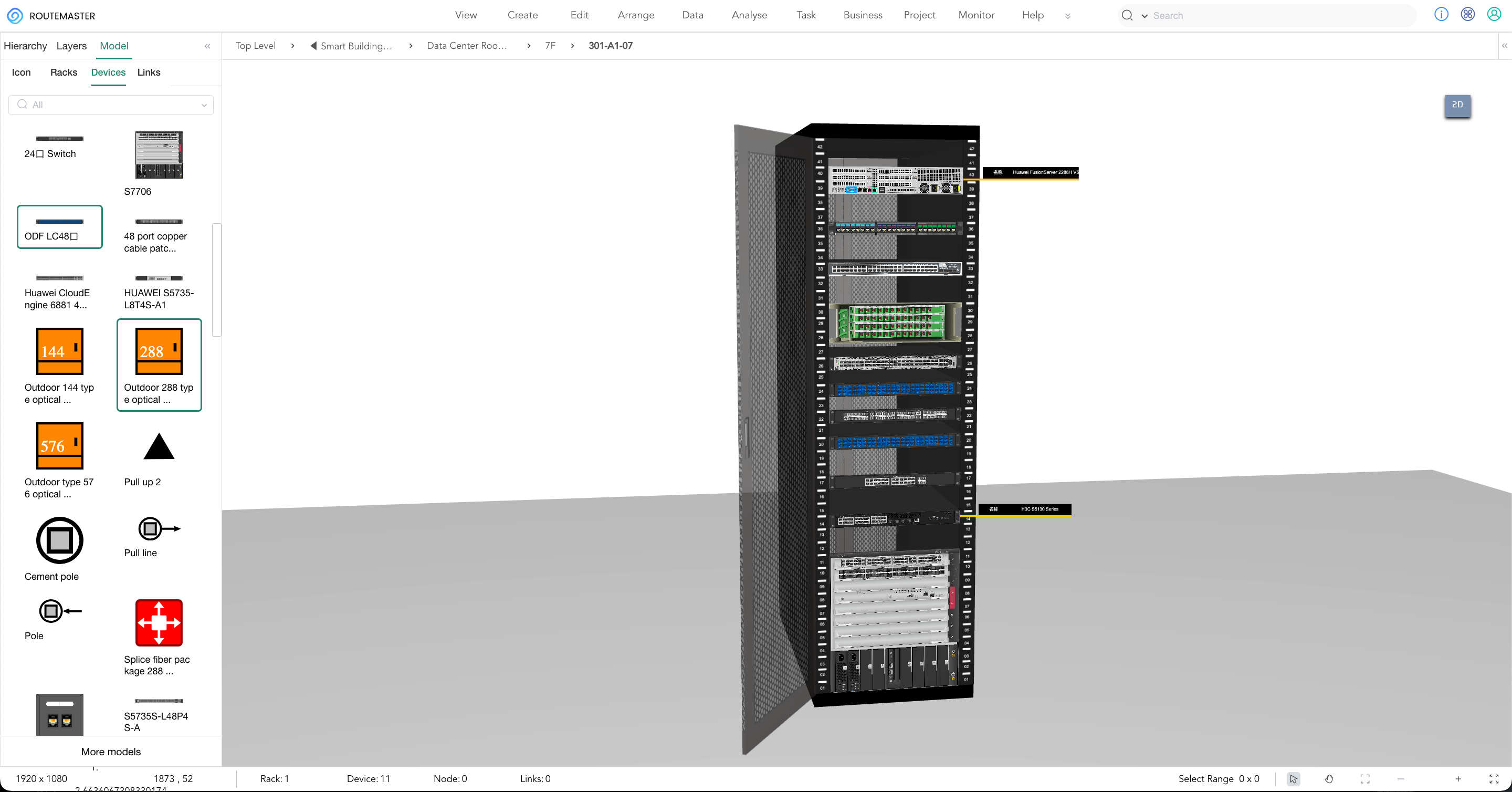


Infrastructure & Operations The Hidden Cost of Bad Cable Management Why 40% of data center downtime is self-inflicted — and what digital twins are doing about it. 40% of data

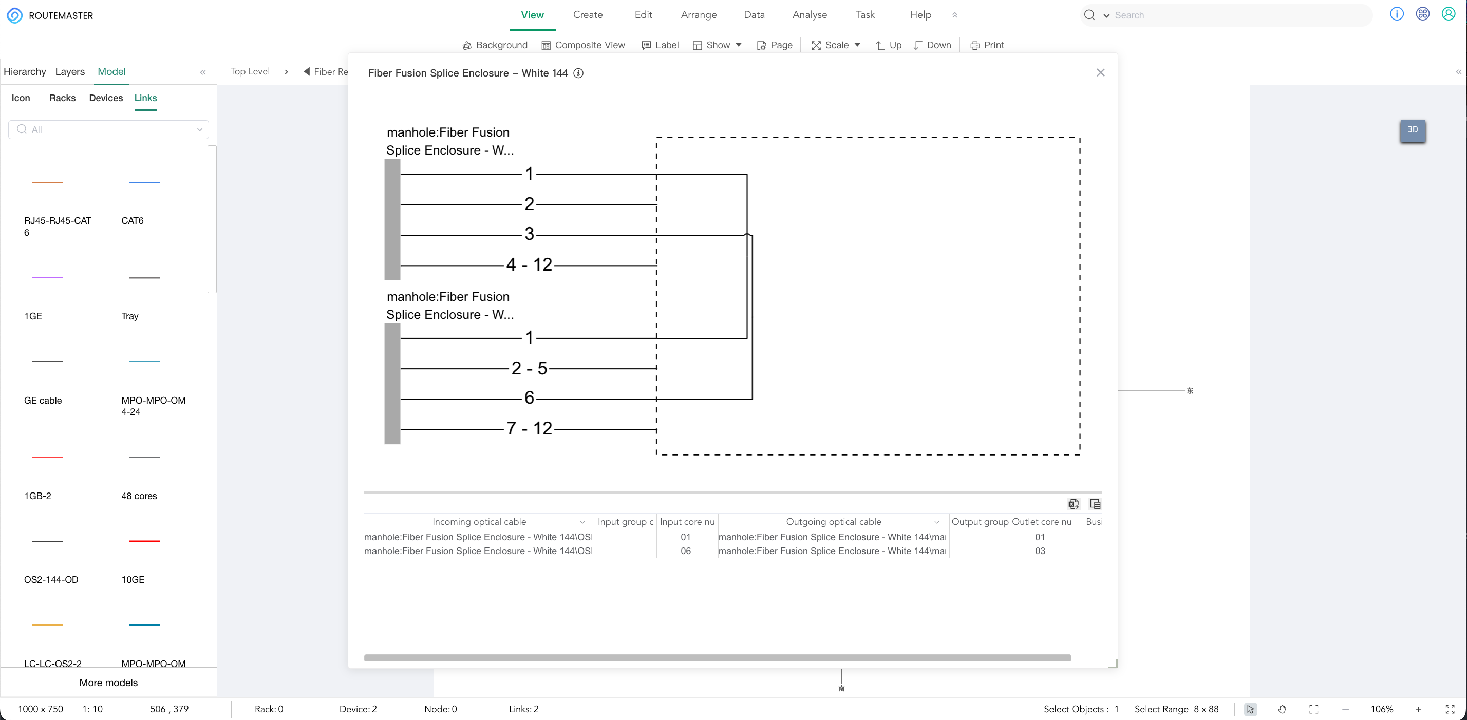
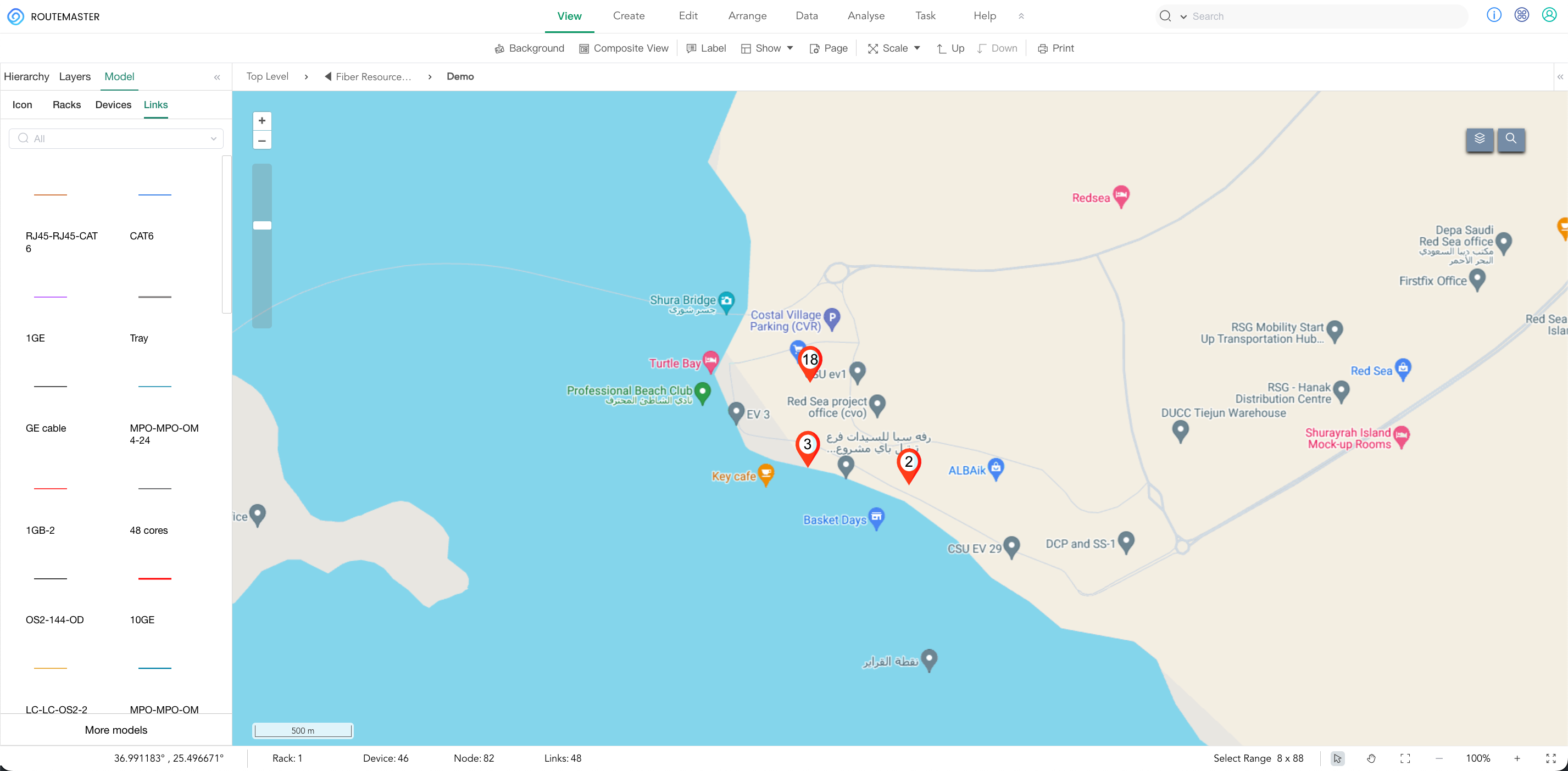
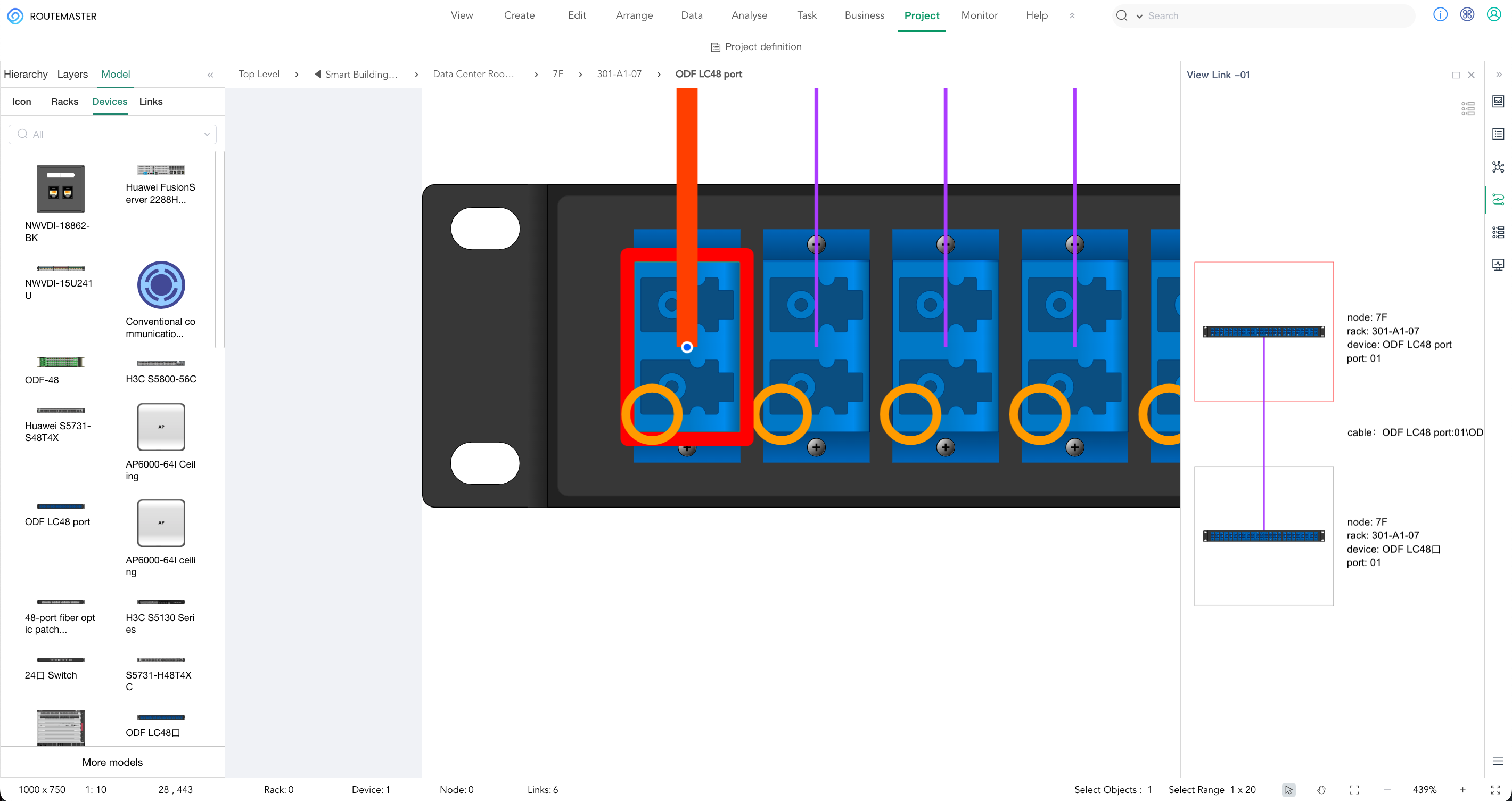
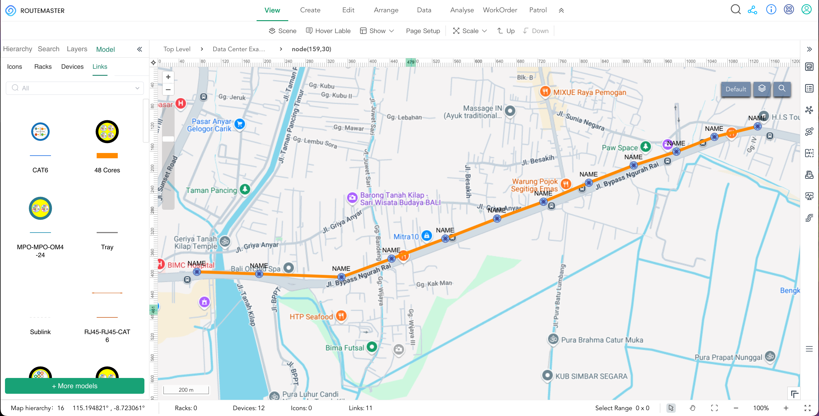
FTTH · Asia · 2026 Asia’s Fiber Boom: Why 2026 Is the Year of the Splice Management Revolution The fiber boom is here. But most operators are managing 15,000+ splice

Asia’s Fiber Boom: Why FTTH Rollouts in 2025 Are Moving Faster Than Ever — and What That Means for Design Teams 50M+New FTTH ports, China 2025 600KVillages, India BharatNet #1APAC

The infrastructure race is on — and fiber is the backbone. $210BIndia AI infrastructure 79New China data centers (last year) UAEMiddle East’s cloud capital The common thread? Fiber. Lots of

Industry Analysis · Asia-Pacific Infrastructure The FTTH Boom in Southeast Asia: Why Design Software Is Becoming Critical Infrastructure Commentary on the massive fiber rollout across Asia-Pacific—and why traditional GIS tools

From 10 Racks to AI-Ready: How One Regional Operator Designed Infrastructure for Open Source LLMs Case Study From 10 Racks to AI-Ready: How One Regional Operator Designed Infrastructure for Open

Infrastructure Insight The Hidden Bottleneck in Your AI Rollout: Why Your Fiber Infrastructure Matters More Than Your GPUs The Real Challenge for Mid-Sized Operators Everyone’s talking about AI infrastructure right now. But

Industry Insight The AI Infrastructure Race Is Here — Can Your Design Process Keep Up? The announcements keep coming: $10B facilities. 500 MW campuses. AI training clusters that didn’t exist

3 Integration Failures We Catch Before Your DCIM Goes Live 3 Integration Failures We Catch Before Your DCIM Goes Live (China Hardware Edition) Flagged another “SNMP-compatible” PDU. Manufacturer’s spec sheet